St. Mary's church is located towards the eastern end of Crosthwaite village, next to the Punch Bowl Inn. For those with sat-navs, the postcode is LA8 8HR.
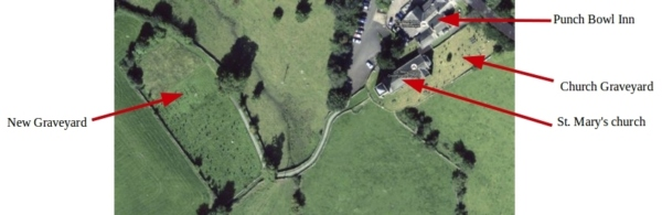
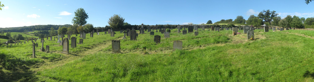
There are two graveyards. The older one is around the church itself, and the new one 100 yards down a track to the west. The two graveyards may be clearly seen in the satellite image.
Links to the various maps and plans are given below. The grave plans are very detailed, and you will need to use your pan and zoom controls once you have opened the image.
Click on a grave number to show all the details.
An outline map of the new graveyard may be found here.
A detailed plan of the graves in the new graveyard (grave references beginning "NG") is here.
A detailed plan of the graves around the church between 1863 and ~1898 (grave references beginning "CG") is here.
A detailed reconstructed plan of the earlier graves around the church to 1862 (grave references beginning "CG_") is here.
A plan of cremated remains on the south side of the tower (references beginning "SS") is here.
A map of the churchyard in 1861 clearly shows the curve of Garnett's wall, and is shown here.
A plan of the inside of the previous church in 1861 is shown here. The tower at the west end does not appear to be shown. The entrance to the church must have been through the base of the tower.
Although there must have been a plan of the graves around the church, it no longer seems to exist, either in the church or the Kendal Public Record office. The only record of the location of the graves from 1797 until 1863 is in the form of written descriptions - e.g.
"John son of John Atkinson of White-Beck was buried April 29th 1801. Aged 28 His Grave is 9 Yards from the East Koin of little Door to the Head, 9 Yards 1 Foot from the Dial post to the Foot, & 6 Yards 1 Foot from Garnett's Wall to the Middle."
This places him in grave CG_P29. The reference points, such as the dial post, Garnett's style no longer exist. Neither can it be assumed that the church walls were in the same place as they are now. Fortunately, all the reference points can be reconstructed from the dimensions to the few marked graves that still exist. The reference points are shown on the plan of the early graveyard. What was the dialpost? Perhaps a sun dial. It has also been possible to establish that the walls of the existing church are in fact on the same footprint as the original church. One puzzle does remain, however. Reference is made to Dixon's tombstone. This is located immediately to the West of the Satterthwaite chest tomb to the South of the church. This also appears on a map of the post 1863 graves. However, there is no trace of a headstone or tombstone for John Dixon today.
On a few occasions, the written descriptions indicate a shared grave. The two sets of distances to those graves are often not quite the same, indicating a degree of inaccuracy in the given measurements. For the purposes of making the plan, it has been assumed that the graves lie on a regular grid. This is convenient, but not necessarily the case. However, after comparing the reconstructed grave positions with the original dimensions in the written record, it has been calculated that the average positional error is around 2½ feet. Probably about 95% of the reconstructed graves are accurately positioned, a further 3% questionable and just 2% which could not be positioned at all due to conflicting or non-understandable descriptions.
)
)